Photo credit: Michigan Sea Grant
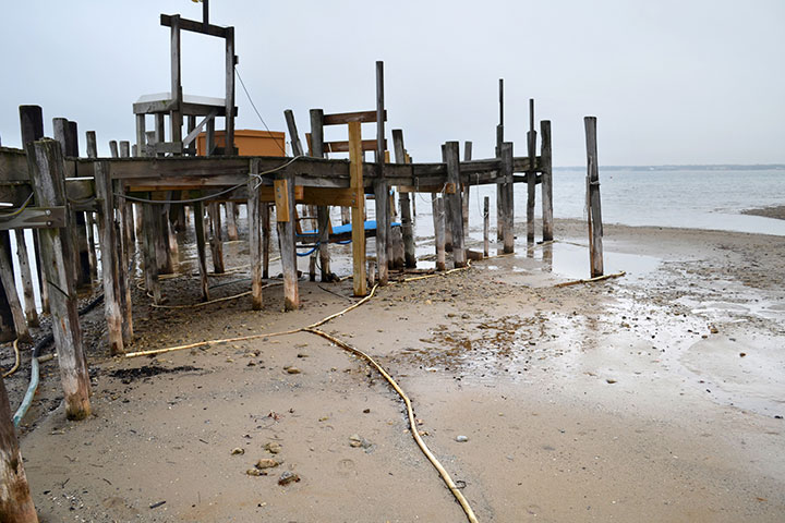
After more than a decade of decline, water levels in Lakes Michigan and Huron reached historic lows in 2013, impacting the economy and ecology of the region. Then during 2013 and 2014 the same lakes came close to setting another record as they experienced one of the largest two-year gains in water levels in recorded history, and underscoring the dynamic nature of the Great Lakes system.
Determining what to do about these changing levels becomes increasingly complex as one considers relatively stable water levels on the lower Lakes Erie and Ontario, contentious debate over engineering options, uncertainty about climate change impacts, and the wide range of affected stakeholders.
| See: IA Report Executive Summary | Full IA Report |
Process & Findings
To help decision makers address the challenges and opportunities posed by Great Lakes water level variability, the Emerging Opportunities Program and Water Center at the Graham Sustainability Institute initiated an Integrated Assessment (IA) that asked:
What environmentally, socially, politically, and economically feasible policy options and management actions can people, businesses, and governments implement in order to adapt to current and future variability in Great Lakes water levels?
With a focus on Lakes Michigan-Huron, the IA aimed to transform extensive existing research about water levels, flows, and impacts into practical, adaptive strategies to address issues facing shoreline property owners and managers.
The IA was informed by a binational advisory committee that provided input and advice reflecting the views of key stakeholder groups. It included collaborative efforts among four multidisciplinary U.S. and Canadian research teams and Great Lakes shoreline communities, as well as a synthesis of findings to identify opportunities for the region.
The final report integrates and builds upon the work of the local projects, drawing upon additional peer-reviewed materials and expert peer review, to demonstrate variation and similarities among the communities’ needs and to identify insights for the basin more broadly. It discusses options for responding to water level variability with a focus on four key approaches: Planning and Coordination; Shoreline Stabilization and Protection; Land Use and Shoreline Management Policies; and Education and Outreach.
You can download the project deliverables and learn more about the process below.
Project Teams
During Phases I and II of the overall project, four teams worked with community partners to assess impacts from and adaptive options for water level variability. Click on the projects below to learn more about these place-based assessments.
Refer to the webpages for each of the place-based project teams to access the Phase I and Phase II reports and additional resources.
Northern Michigan - Consideration of the impacts of climate change on lake levels in management plans of tribal fisheries and culturally important sites
Southern Michigan - Implementing adaptation: Developing land-use regulation and infrastructure policy to implement Great Lakes shoreland area management plans
Resources
Project Reports
IA Process
The IA was informed by a binational advisory committee with representatives from government, business, and non-governmental organizations. The committee’s role was to provide input and advice reflecting the views of key stakeholder groups and to ensure the IA scope was relevant to decision makers. Committee members also provided data and input throughout the process, including feedback on the policy topics, analytic approach, format of the IA, and review of draft reports. All final decisions regarding content of project analyses and reports were determined by project personnel and researchers.
- Jon Allan - Office of the Great Lakes, Michigan Department of Environmental Quality
- John Allis - Great Lakes Hydraulics and Hydrology Office, US Army Corps of Engineers - Detroit District
- Mark Breederland - Northwest District, Michigan Sea Grant
- Kathryn Buckner - Council of Great Lakes Industries
- Matthew Child - International Joint Commission, Great Lakes Regional Office
- Gene Clark - University of Wisconsin Sea Grant Institute
- John Coluccy - Ducks Unlimited
- Patrick Doran - The Nature Conservancy
- Bonnie Fox - Conservation Ontario
- Gail Hesse - National Wildlife Federation
- Erin Kuhn - West Michigan Shoreline Regional Development Commission
- Wendy Leger - Environment and Climate Change Canada
- Scudder D. Mackey - Office of Coastal Management, Ohio Department of Natural Resources
- David Powers - Smith, Martin, Powers & Knier; Save our Shoreline
- Larry J. Robson - Great Lakes Coalition
- David Sweetnam - Georgian Bay Forever
- Kathy Tank - Wisconsin Harbor Towns Association
The IA Plan (PDF) provides an overview of the goals and process of the project.
Stakeholder engagement was a key component of the IA, and the project included a number of opportunities to generate broader participation and feedback:
Public Meeting - On May 17, 2016 multidisciplinary experts from the U.S. and Canada came together to share information with interested stakeholders at a public meeting (in-person and live-streamed) about Great Lakes water level variability, adaptation, and Phase I of the IA. View and download their presentations on the public event webpage.
Webinar Series - In November and December 2016 the IA teams presented webinars on the findings of their Phase II work analyzing policies and adaptive actions for the communities with whom they were working. View the presentations on the webinar webpage.
Public Comment - A 30-day public comment period was held to solicit feedback on the final IA report. Comments will be summarized and made available with the final report in order to further promote the sharing of diverse perspectives around this issue.
Resources
In addition to IA reports, the Graham Sustainability Institute has prepared and compiled additional resources for understanding lake level variability.
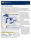
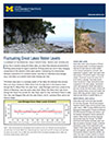
In collaboration with partners at NOAA’s Great Lakes Environmental Research Laboratory (NOAA-GLERL), the Graham Institute developed fact sheets that provide overviews of the Great Lakes water budget and fluctuations in water levels.
In the fall of 2014 the Graham Sustainability Institute conducted an online survey of over 1,800 Great Lakes property owners and managers from the U.S. and Canada in order to help inform the scope of the Integrated Assessment. The survey collected data on property owners’ perceptions of the causes and consequences of water level change, as well as their preferences for obtaining water-level ralted information. Click on the link below to read the final report.
Experiences and perceptions of Great Lakes water level change: a survey of shoreline property owners (PDF)
Investigator: Rachel Jacobson
Other Resources & Tools
- NOAA Lake Level Viewer - Web-based tool creates visuals illustrating changes in Great Lakes water levels from six feet above to six feet below the historical long-term average.
- NOAA-GLERL Great Lakes Water Levels - Website provides information and tools addressing how water levels are measured, current and historical water levels, and water levels projections.
- Great Lakes Coastal Resilience Planning Guide - On-line resource that shows how coastal communities are addressing coastal hazards such as lake-level fluctuations, shore erosion, and flooding. Features case studies, maps, data, tools, and other information. The Planning Guide is a collaborative effort of the NOAA Digital Coast partnership and additional community-based partners from the Great Lakes.
- Living on the Coast: Protecting Investments in Shore Property on the Great Lakes - Report developed by the U.S. Army Corps of Engineers and University of Wisconsin Sea Grant Institute that provides coastal property owners and managers useful information on coastal processes and options for protecting shoreline property investments.
- Living with the Lakes: Understanding and Adapting to Great Lakes Water Level Changes (PDF) - A 1999 report by the U.S. Army Corps of Engineers and the Great Lakes Commission that provides a comprehensive overview of hydrologic and hydraulic factors affecting the Great Lakes – St. Lawrence River watershed and human uses of the resource.
- 1993 International Joint Commission Levels Reference Study Report (PDF) - Additional related reports are available on the IJC website
- International Upper Great Lakes Study - Website for the IJC's bi-national team effort spanning more than five years
- Great Lakes Coastal Reslience Planning Guide - Web resource for coastal hazards such as lake-level fluctuations, shore erosion, and flooding. Features case studies, maps, data, tools, and other information.
For more information, please contact Maggie Allan at (734) 763-0749 or [email protected].
The University of Michigan Graham Sustainability Institute and Water Center, Michigan Coastal Zone Management Program, and NOAA provided a total of $200,000 to 4 project teams in 2015.


