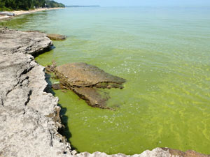
Harmful algal blooms (HABs) are a major environmental issue in the Great Lakes and beyond, due to their ability to impair water resources and threaten public health security, with potentially severe ecological and socio-economic consequences. Our ability to understand the factors triggering HABsoccurrence and to develop predictive models that inform resource managers and policy makers, is dependent upon the accurate characterization of bloom spatiotemporal (space and time) dynamics.
A project team led by Dr. Gary Fahnenstiel, at the Michigan Tech Research Institute (Michigan Technological University) and the Water Center, developed ad-hoc remote sensing algorithms to map cyanobacteria bloom occurrence in three eutrophic basins of the Great Lakes: the Western Basin in Lake Erie, Green Bay in Lake Michigan, and Saginaw Bay in Lake Huron. Researchers generated a near-term record (2002-2013) of HAB distribution maps for each of these basins, using these algorithms to process Moderate Resolution Imaging Spectroradiometer (MODIS) satellite imagery. The analysis of these new time series of images indicated a recent increasing trend in HAB occurrence in the western basin of Lake Erie, but not in Green Bay or Saginaw Bay. Similarly, the development of extensive surface scums (extremely dense surface bloom accumulations) was a common occurrence in western Lake Erie but not in the other basins.
The satellite-based HAB monitoring products, developed as part of this project, are already being used by researchers to investigate relationships between the extent of HABs and environmental drivers over time. These studies will ultimately improve the ability to detect and predict HABs in different regions of the Great Lakes.
See the publication in the ‘Products’ section of this issue of the August Water Center Update